
:The Mile High City:
Denver is centrally located and lies in the foothills of the Rocky Mountain region. Located on high plains at the eastern base of the Rocky Mountains, Denver has a sunny, cool, dry climate. The sun shines 300 days a year and the usually mild climate and nearby Rocky Mountain playground have made tourism one of the Mile High City's economic mainstays. With a lower cost of living compared to most major cities, exemplary health care and world class medical research facilities, massive rapid transit expansion plans, and abundant cultural and recreational opportunities, Denver is one of the nation's best cities.


 ...you can see from the picture, the size of the brewery.
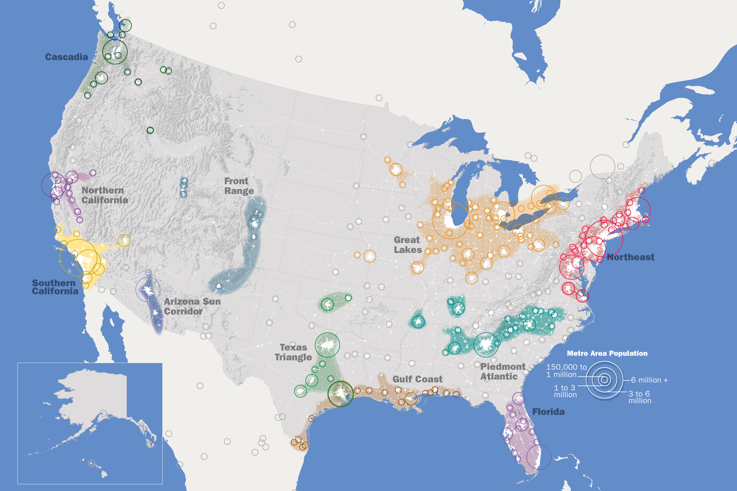


 The Denver metropolitan area consists of eight counties including all of Denver and Broomfield Counties and parts of Adams, Arapahoe, Boulder, Douglas, Elbert, and Jefferson Counties. The metro area stretches over 4,500 square miles from Golden to the west to Watkins to the east. The northernmost city is Longmont and the southernmost location is Castle Rock.
 Generally the foothills are considered the higher terrain between 6,000 and 9,000 feet west of Denver that parallel the Front Range Mountains. The foothills stretch from Roxborough State Park north to the west side of Fort Collins. Evergreen, Morrison, Genesee, Nederland, and Red Feather Lakes are all examples of foothill locations.
  The Palmer Divide is a ridge of higher terrain that extends from the Front Range of the Rockies in central Colorado, eastward toward the city of Limon on the Eastern Plains. It separates the Arkansas and Missouri River basins. Cities along the Palmer Divide include Monument, Castle Rock, Parker, Kiowa, and Elbert. It is named after William Jackson Palmer who founded Colorado Springs in 1871.
 The Front Range urban corridor is the area immediately east and west of Interstate 25 from Cheyenne, Wyoming to Pueblo. More than 85 percent of Colorado’s population lives along the urban corridor within the Fort Collins, Greeley, Boulder, Denver, Colorado Springs, and Pueblo metropolitan areas.
 The Eastern Plains (or just “Plains”) is considered all areas of Colorado east of Interstate 25. Sterling, Limon, Burlington, Lamar, La Junta, and Springfield are examples of Eastern Plains locations.
  Specifically the Front Range in Colorado is the eastern most mountain range of the Rocky Mountains stretching from Pikes Peak to the Colorado/Wyoming state line. However, the term “Front Range” is used to loosely describe any area from the urban corridor west to the Continental Divide.
  Any location above 9,000 feet in elevation is generally considered a mountain area. There are three mountain regions in Colorado.